A Breath of Fresh Air: Wollongong’s Heatwave Set to Break This Wednesday
Overview: The Long-Awaited Transition
After a period of intense and prolonged summer heat that has gripped the Illawarra region, residents of Wollongong can finally look forward to a significant shift in the weather. Wednesday, 28 January 2026, marks the turning point for the local climate as a high-pressure system begins to give way to a much-anticipated cool change. While the morning will retain the warmth of the previous days, the afternoon and evening are predicted to bring the first real relief from the scorching 'heat engine' that has been pulling hot air across New South Wales.
Morning: Sunny Skies and Rising Mercury
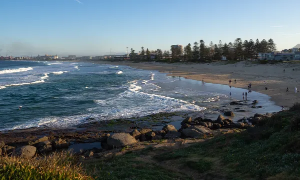
The day is expected to begin with clear, brilliant sunshine across the city and northern suburbs. Early morning temperatures will start at a comfortable 18°C to 20°C, making it an ideal window for those looking to enjoy the coast before the peak heat hits. By mid-morning, the mercury will climb rapidly, heading toward a forecast high between 28°C and 31°C. Humidity levels will hover around 76%, adding a slight mugginess to the air. Those heading to North Wollongong or Belmore Basin are advised to take advantage of these early hours while the conditions remain stable and the sea breeze is still finding its strength.
Afternoon: The Cool Change Arrives
The afternoon is when the most dramatic change occurs. Weather models indicate that the dominant coastal winds will shift, potentially bringing an easterly or southerly influence that will effectively 'break' the current heat spell. This transition period may see an increase in cloud cover as the hotter inland air meets the cooler maritime flow. While the day remains mostly sunny, patchy clouds will begin to gather by the late afternoon. Meteorologists suggest that while inland areas may see a dry change, the coastal strip of Wollongong could experience light, patchy rain as the front moves through, though significant totals are not expected.
Evening: Fresher Breezes and Restful Sleep
As we move into the evening, the temperature is slated to drop back toward a minimum of 17°C to 18°C. The oppressive heat of the last few nights will be replaced by fresher breezes, providing much-needed relief for local households. The chance of rain increases slightly to about 15% overnight, primarily in the form of light coastal showers. This shift sets the stage for a much cooler second half of the week, with Thursday expected to be significantly milder.
Safety and Preparation
- Hydration: Continue to drink plenty of water, especially during the peak warmth of the morning and early afternoon.
- UV Protection: The UV index remains high at 9; sun protection is essential between 9:00 AM and 5:00 PM.
- Evening Travel: Keep an eye on local wind conditions if you are near the water, as the change can bring sudden gusts.
Rock Orchestra and Fine Art Highlights: What’s On in Wollongong Today
Wollongong Morning Briefing: Coastal Safety and Community Sweets

Mt Ousley Carpark Closure and Nightly Lane Restrictions for Tuesday Commuters